Drone Technology to Improve Municipal Finance and Resource Planning in uMhlathuze, South Africa
What are the reasons if cities experience a big discrepancy between their calculated water demand and actual water consumption? Non-revenue water through leakages? Illegal water connections? A mistake in the calculations?
In 2019, the City of uMhlathuze experienced exactly this problem. A gap analysis commissioned by NatuReS confirmed the urgent need for the municipality to act on the improvement of water supply to traditionally managed areas, while decrease the unbilled consumption. To meet this objective, two pilot studies were undertaken, using drone technology to measure population increase, calculate average per capita water consumption, understand the extent of water losses and improve planning. All this aimed at increasing water supply.
Copyright: Dawid Dierks
Increase water supply by gathering data from drone images
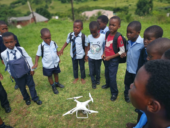
The village of Gobandluvo and Vulindlela were chosen as pilot areas to determine the population and subsequent water demand, using Remote Pilot Aircraft System (RPAS) technology, also known as drone technology.
Aerial photos of Gobandluvo were compiled from autonomous drone flight information, indicating the most recent developments. The aerial photos were geo-referenced over the existing zonal areas, as well as over the two project focus areas. From these photos, the represented structures were counted and divided into the following categories: households, rental rooms, student housing and schools. This information was then used to calculate the theoretical water demand and compared to the actual water demand in the area.
Findings guide targeted interventions
The findings of the investigation highlighted that the population had increased dramatically from the most recent census in 2011, which consequently influenced the water demand calculations. The area of Gobandlovu, marked as “High Water Loss Area”, requiring a high priority for water conservation intervention, was found to be close to expected water consumption per capita standards. However, the population of Gobandlovu was three times higher than the 2011 census. The municipality had assumed that the area had a high per-capita consumption, which it didn’t. Simply, the size of the population in the area had tripled and with it the water demand. An additional problem was the number of illegal and unbilled connections, which have a negative fiscal impact on the municipality.
With the obtained information gained from drone technology, the municipality can now decide on targeted actions to e.g. reduce illegal connections or upgrade the infrastructure to meet communities’ demand.
Copyright: GIZ/Jesper Anhede
The way forward
As the pilot intervention represented a big success, NatuReS donated a drone to the municipality and is supporting three municipal officials in obtaining their drone licenses. This will help the municipality to carry out similar exercises in other areas, and additionally use the drone for more interventions like:
- Leak detection – using infrared camera
- Point leak detection – for high level reservoirs
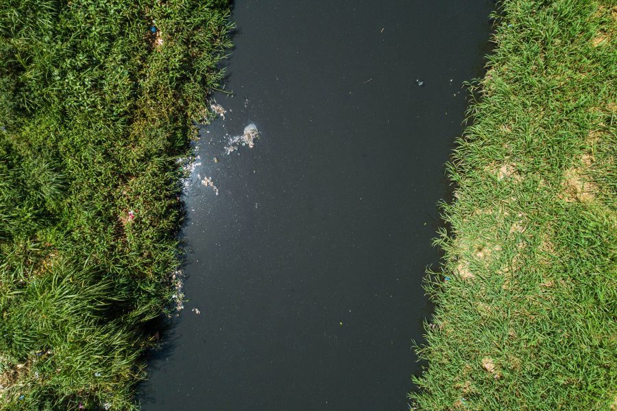
- River flow investigation – discover illegal structures
- Surveillance over invasive plant species
- Population count
- Construction management progress reports
- Spillage identification
- Quantity survey
This will tremendously improve the service delivery and development planning for communities, as well as water demand management, budgetary planning and water loss reduction in the City of uMhalthuze.