Partnership progress towards jointly tackling flooding in Greater Kampala
Baseline study and scoping process for the Greater Kampala Integrated Flood Resilience Partnership
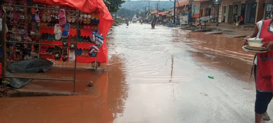
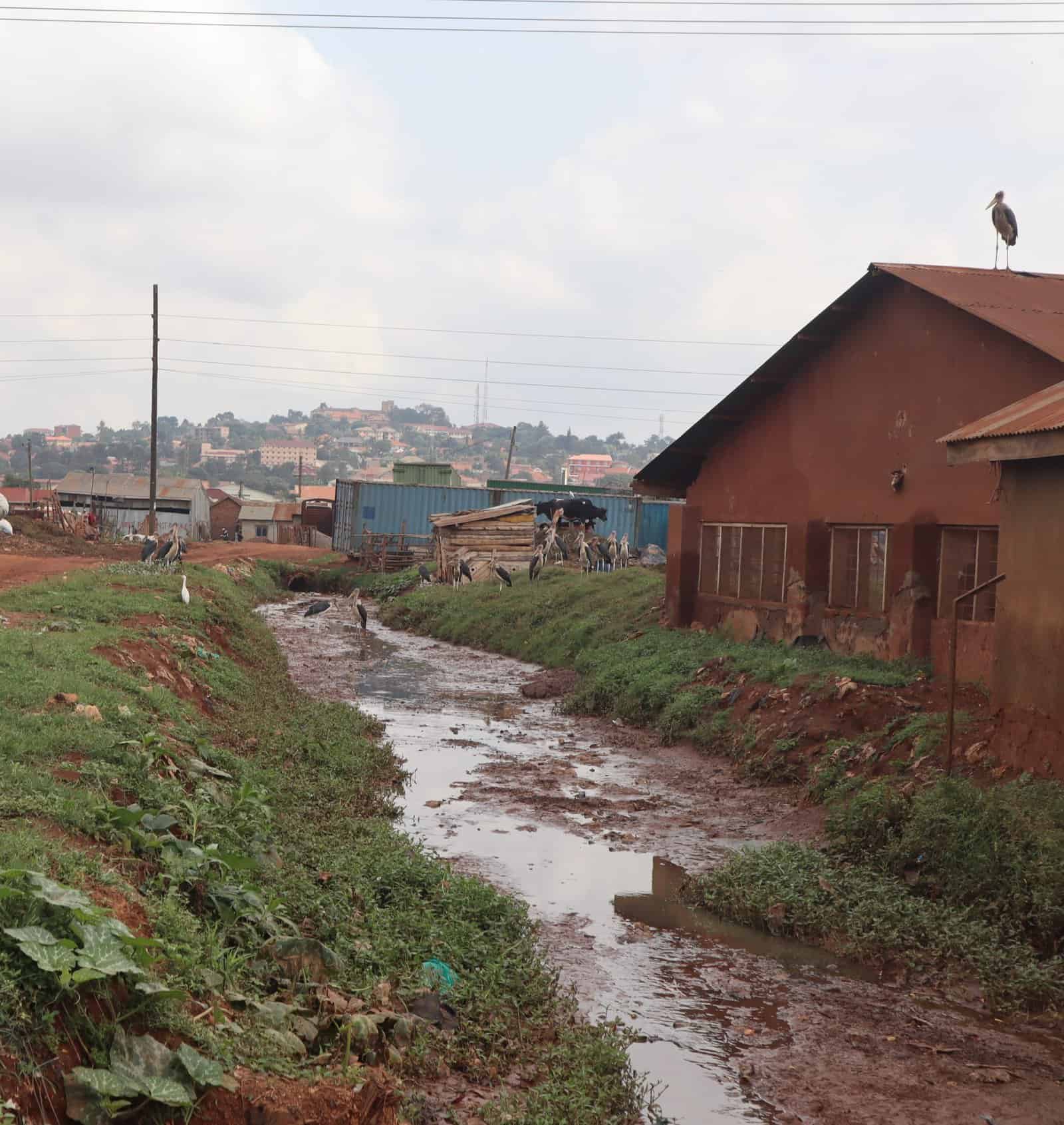
The Greater Kampala Metropolitan Area (GKMA) regularly experiences devastating flash floods. These are partly caused by an increase in impermeable surfaces due to rapid and unplanned urban development. Furthermore, improper solid waste disposal leading to clogged drainage channels, as well as a lack of community awareness and participation in the operation and maintenance of drainage networks, have worsened the situation. Floods pose serious socio-economic challenges to both businesses and residents in the area, as workplaces cannot be reached, products not be delivered and clients cannot access businesses. This is threatening both jobs and investment.
To mitigate and adapt to the current flooding challenges, government, private actors, and civil society organizations are now collaborating under the Greater Kampala Integrated Flood Resilience Partnership. They work together to pilot blue-green infrastructure solutions, which include promoting rainwater harvesting, regreening of open spaces to increase infiltration capacity and reduce runoff, and solid waste management through solid waste re-use and recycling schemes. This is intended to promote inclusive engagement in flood control in up to two sub/micro-catchments in Greater Kampala for improved urban resilience to flooding and consequently enhanced socio-economic development.
Partnership Development
During their first partnership meeting, partners agreed to rally around the partnership concept and followed this up by submitting Letters of Intent (LOI) to confirm their commitment and nominate partnership focal persons. These partners include: the Ministry of Water and Environment (MWE), the Ministry of Lands, Housing and Urban Development (MoLHUD), National Environment Management Authority (NEMA), Kampala Capital City Authority (KCCA), Uganda Manufacturers Association (UMA), Britannia Allied Industries Ltd (specialised in manufacturing biscuits, confectionery, juices and sauces) and the civil society organisation ACTogether Uganda (a local Non-Governmental Organization affiliated with Slum Dwellers International).
Thereafter, a preliminary scoping study was initiated to better understand the current flash flooding situation in Greater Kampala and inform partnership interventions. During the inception meeting, it was agreed that the study would be conducted across the five proposed sub-catchments Nakivubo, Kinawataka, Lubigi, Namanve, and Nalukolongo, with the goal of narrowing it down to two critical sub-catchments for piloting blue green interventions (rainwater harvesting, regreening, solid waste management).
The study focused on:
- Mapping and generating evidence on flooding hotspots
- Quantifying socio-economic impacts and risks from flooding
- Identifying quick-win opportunities of investing in blue-green solutions against flooding
A local environmental consultancy ‚Aidenvironment‘ was contracted to conduct the study on behalf of the partnership, alongside partners. The assignment started in November 2021 and was completed in February 2022.
Flood situation and hotspot analysis
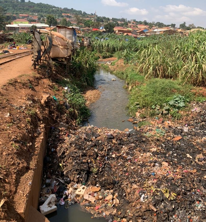
The speed of flood water experienced in the study area is generally less than 0.5m/s, which is considered moderate. Even though in some areas a speed of flood water of more than 1.0m/s has been measured, these are not considered dangerous for humans, unless combined with deep water. However, stakeholder consultations in the area revealed that dangerously deep and fast-flowing flood water can occur in local hotspots, if erosion or blockages come together, representing a serious risk for inhabitants, particularly children, elderly and people with health issues.
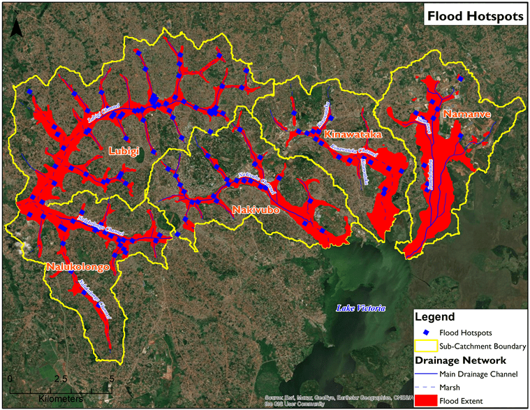
According to the findings, there are 148 flood hotspots across the five catchments. The total flood area is 208.7 KM2, as can be seen in the area marked red in the map below.
Stakeholder and institutional analysis
During the initial scoping phase, key stakeholders relevant to finding solutions for flood management were identified. They were mapped according to their power and influence over flood resilience interventions and then categorized based on their mandate and shaping power in relation to flood management and implementation of blue-green infrastructure solutions in Greater Kampala.
Selecting the two most critical sub-catchments
The scoping findings informed partners to implement jointly agreed measures in the Nalukolongo and Kinawataka sub catchments, as these promise the highest chances of success for blue-green infrastructure implementation, taking into consideration the relevance in these areas to safeguard jobs and investments threatened due to flooding. Furthermore, ACTogether’s relationship with Kinawataka and UMA’s ongoing engagement with its members in Nalukolongo regarding flood management aided in the selection of these two sub-catchments.
Concepts for nature-based blue-green infrastructure solutions
Following this decision, four blue-green infrastructure concepts were developed for implementation in the Nalukolongo and Kinawataka sub-catchments. The concepts developed include rainwater harvesting, regreening, solid waste management, and a detention pond. Blue-green solutions are innovative in that they offer a long-term natural solution to urban flooding by reintroducing a more natural water cycle into urban environments, while providing environmental, social and economic benefits. Communities are healthier if they are not threatened by dangerous floods or diseases developing in stagnant waters. Businesses benefit from reduced flooding risk to maintain their operations.
Partnership Action Plan: Working group meetings
Copyright: GIZ/Daniel Ochieng
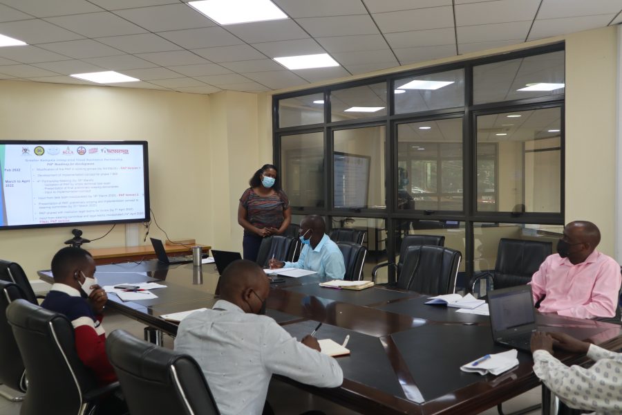
On February 23rd and March 4th, 2022, the partners held two working group meetings to refine the Partnership Action Plan (PAP). These meetings took place at the Ministry of Water and Environment. Furthermore, partners agreed that after the preliminary scoping is completed, an implementation concept for BGI will be developed. Joint commitment and a commonly agreed way forward are important steps in the partnership development to prevent flooding in Greater Kampala in the long term. This is especially the case as lack of coordination and collaboration often represents a significant hurdle to developing lasting solutions.
The implementation concept
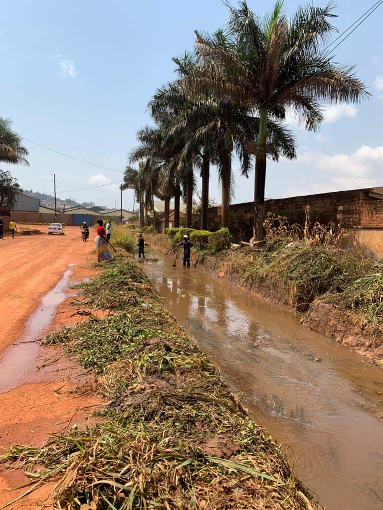
Following the completion of the scoping study, a draft implementation concept was developed to guide the construction of Phase 1 blue-green infrastructure. The concept presents clear flood hotspots, as well as proposed interventions and implementation methods. It is guided by specific goals that aim to reduce flood volumes by encouraging rainwater capture, increasing infiltration capacity by regreening open spaces and drainage channels, and reducing solid waste blockage in drainage channels.
Field visits to two catchments: Nalukolongo and Kinawataka
The partners on 15th and 25th February conducted field visits to the Kinawataka and Nalukolongo sub-catchments respectively to reconfirm flood hotspots and identify areas with the best chances of success for blue-green infrastructure implementation. Interventions, namely rainwater harvesting, regreening of secondary drainage channels and selected patches of public institutions, and reducing solid waste entering drainage channels, will take place in the Kinawataka sub-catchment in the parishes of Ntinda, Kyambogo, Mbuya I and II, and Banda, and in the Nalukolongo sub-catchment in the parish of Mutundwe. It is worth noting that these field trips contributed to the development of the implementation concept by allowing the partners to better understand the causes of flooding in flood hotspots and determine which blue-green solution is appropriate where.
Copyright: GIZ/Daniel Ochieng and Tyaba Vanessa
Way forward
Moving forward, partners will agree on concrete blue-green solutions to be implemented, before validating and approving the Partnership Action Plan (PAP), which will represent the partners’ guiding thread throughout the course of the partnership. Meanwhile, Deltares, a research institute on water and subsurface, was hired to provide the partnership with technical support. It will begin the inception (gathering necessary information for flood modelling) and situation analysis stages. Subsequently, partners agreed to convene for a fourth partnership meeting to validate the PAP and the implementation concept; tender for a firm to undertake design and supervision of construction work; and finally sign and launch the PAP.
Joining forces for a common goal: make Greater Kampala flood-resilient
Increasing Greater Kampala’s resilience towards flooding is a complex task. No single actor can tackle this challenge alone, yet everyone is impacted by the risks stemming from devastating floods. And the risk for flooding is even foreseen to increase in the future due to a changing climate and yet to be unfolding new rainfall patterns.
However, with partners from the public sector, private companies, as well as communities and civil society organisations joining forces, a roadmap is now in place to develop joint long-term solutions to minimize the risk of dangerous floods across the city. The systemic approach of the Natural Resources Risk and Action Framework (NRAF) provided specific tools and framework conditions to enable the formation and implementation of the partnership during the past months. Partners along this process jointly decided to implement integrated flood risk management solutions, including a mix of catchment management and engineering solutions, particularly investing in nature-based blue-green infrastructure.
By applying a stewardship approach, empowering all users of natural resources to take responsibility for the available resources and develop collaborative solutions for their sustainable use, partners have set the scene for making Greater Kampala more resilient to flooding in the long-term.